Dorogawa to Kameyama
<< Previous Day | Next Day >> | Photo Album | Video
- Weather: Wet, then rainy, clearing by late afternoon
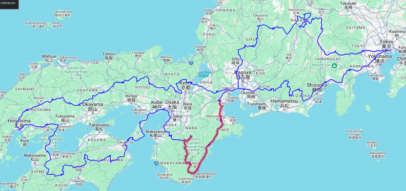
- Ride: 331km; nice windy roads down to Nachi, then an incredibly boring highway to Kameyama
- Stay: Tabist Kameyama Daiichi Hotel; just a business hotel with no undercover parking for bikes.
Woke up relatively early and moved back into my allotted room. Our original bedroom was very bright due to a hallway light, and Ben had already relocated into our sitting room, so I had snuck myself and my futon into the unused room next door, where I had a great night’s sleep. I did a bit of blogging and then a quick onsen before breakfast. We had decided to leave a bit later today to allow the rains to clear.
We set off around 8:30 and enjoyed some nice, albeit wet, roads. About an hour away from Nachi we parted ways as I decided I wanted to explore a more windy road while Ben preferred to stay on the main roads in the wet. Again, his decision was the correct one as the road I chose, while initially fantastic, soon turned into quite a challenge, being very narrow with lots of debris on it. It wasn’t quite one of the abandoned roads I’ve explored previously, but it was well on its way to becoming one. Still, there were some amazing views, amongst them a nice waterfall in a river bend with some rice fields in the foreground, an abandoned village with rice terraces now overgrown by trees, and some awesome views into the surrounding valleys.
In the middle the road suddenly became better and I encountered a group of work trucks and some people repairing a power line. I have no idea how the trucks got there because the road soon turned pretty bad again, and I’m sure all approaches were not suitable for truck traffic. I guess they must have managed somehow.. Nearly at Nachi I crested one last rise and unexpectedly found a lookout, shrouded in mist, where a couple of British tourists had hiked their way to. Poor buggers – they found the same conditions that they had left behind, cold and rain..
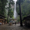
I ended up arriving nearly an hour after Ben at Nachi due to the much worse than expected roads and we quickly went up to see the waterfall. It is the highest free-falling waterfall in Japan, at 133m drop. It is also considered to enshrine the local deity. All up very impressive. We spent some time just admiring the sheer spectacle.
After a quick lunch we jumped back on our bikes for the stretch up to Kameyama, which we did mostly via expressways and highways. For what it’s worth, the E42 is dreadful – don’t get me wrong, it’s a good quality road, but about 80% is tunnels and dual-way with little to no overtaking opportunities, so rather unsuited for motorbike touring. Still, it’s a way to get from A to B relatively quickly by Japan standards.
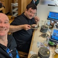
Notwithstanding a minor routing mishap, we arrived at our accommodation in good time, checked in, and then had a conveyor-sushi dinner.
Time for bed.. Ben and I will split ways tomorrow as he wants to get up very early and highway it home as quickly as possible, whereas I will take the more scenic option at least until Mt Fuji.


