• Tag Archives travel
  • Hiroshima Tour – Day 9

    Dorogawa to Kameyama
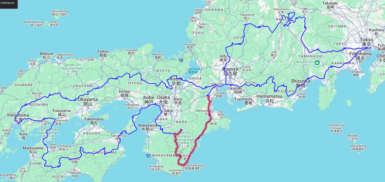
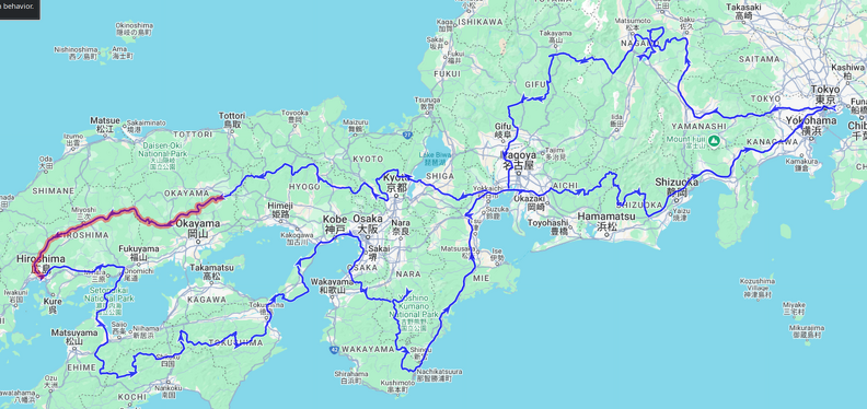
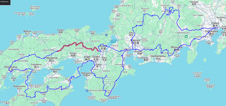
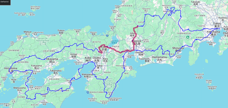
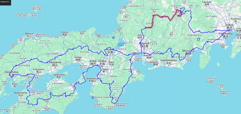
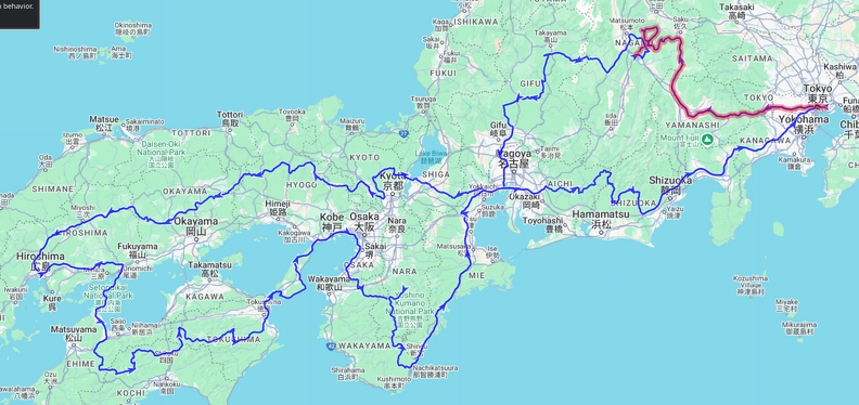
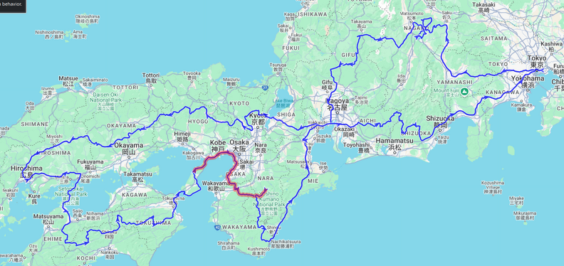
    Hiroshima Tour Route Map - Day 9

Length: 331km, ↗5555m, ↘6335m
Time: 09:11:54h, Speed: 36.0km/h
Moving: 06:35:15h, Speed: 50km/h

Start: Saturday, 10 May 2025 08:30:45 JST
End: Saturday, 10 May 2025 17:42:39 JST
Points: 5019 (5019)

    << Previous Day | Next Day >> | Photo Album | Video

    • Weather: Wet, then rainy, clearing by late afternoon
    • Ride: 331km; nice windy roads down to Nachi, then an incredibly boring highway to Kameyama
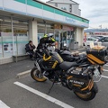
    • Stay: Tabist Kameyama Daiichi Hotel; just a business hotel with no undercover parking for bikes.
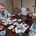
    Dorogawa Onsen - breakfast at Marubun hotel.

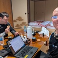
    Woke up relatively early and moved back into my allotted room. Our original bedroom was very bright due to a hallway light, and Ben had already relocated into our sitting room, so I had snuck myself and my futon into the unused room next door, where I had a great night’s sleep. I did a bit of blogging and then a quick onsen before breakfast. We had decided to leave a bit later today to allow the rains to clear.

    We set off around 8:30 and enjoyed some nice, albeit wet, roads. About an hour away from Nachi we parted ways as I decided I wanted to explore a more windy road while Ben preferred to stay on the main roads in the wet. Again, his decision was the correct one as the road I chose, while initially fantastic, soon turned into quite a challenge, being very narrow with lots of debris on it. It wasn’t quite one of the abandoned roads I’ve explored previously, but it was well on its way to becoming one. Still, there were some amazing views, amongst them a nice waterfall in a river bend with some rice fields in the foreground, an abandoned village with rice terraces now overgrown by trees, and some awesome views into the surrounding valleys.

    In the middle the road suddenly became better and I encountered a group of work trucks and some people repairing a power line. I have no idea how the trucks got there because the road soon turned pretty bad again, and I’m sure all approaches were not suitable for truck traffic. I guess they must have managed somehow.. Nearly at Nachi I crested one last rise and unexpectedly found a lookout, shrouded in mist, where a couple of British tourists had hiked their way to. Poor buggers – they found the same conditions that they had left behind, cold and rain..
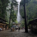
    At the Nachi waterfall and temple complex.

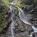
    I ended up arriving nearly an hour after Ben at Nachi due to the much worse than expected roads and we quickly went up to see the waterfall. It is the highest free-falling waterfall in Japan, at 133m drop. It is also considered to enshrine the local deity. All up very impressive. We spent some time just admiring the sheer spectacle.

    After a quick lunch we jumped back on our bikes for the stretch up to Kameyama, which we did mostly via expressways and highways. For what it’s worth, the E42 is dreadful – don’t get me wrong, it’s a good quality road, but about 80% is tunnels and dual-way with little to no overtaking opportunities, so rather unsuited for motorbike touring. Still, it’s a way to get from A to B relatively quickly by Japan standards.
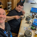
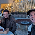
    Converyor belt sushi dinner in Kameyama.

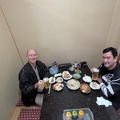
    Notwithstanding a minor routing mishap, we arrived at our accommodation in good time, checked in, and then had a conveyor-sushi dinner.

    Time for bed.. Ben and I will split ways tomorrow as he wants to get up very early and highway it home as quickly as possible, whereas I will take the more scenic option at least until Mt Fuji.
  • Hiroshima Tour – Day 8

    From Awaji to Dorogawa

    Hiroshima Tour Route Map - Day 8

Length: 214km, ↗4645m, ↘3825m
Time: 09:17:48h, Speed: 23.0km/h
Moving: 04:25:43h, Speed: 48km/h

Start: Friday, 9 May 2025 05:58:27 JST
End: Friday, 9 May 2025 15:16:15 JST
Points: 3797 (3797)

    << Previous Day | Next Day >> | Photo Album | Video

    • Weather: Started overcast, then rainy, but warm-ish
    • Ride: an hour or so of highway to get past Kobe, then nice windy forest roads.
    • Stay: Hot Spring Hotel Marubun; very nice! Owner let us park bikes in a shed next door.

    Set the alarm for 5am, but didn’t really get going till nearly 6:30. Quickly went across the road from the accommodation to check out the local shrine while sipping a coffee. It wasn’t too far down the road until we got onto the highway, which was mostly clear except for a small section through Kobe which had heavy traffic. Some interesting views of industrial facilities, harbours, and a couple of big bridges.

    Combini Breakfast!
    At Shipporyuji temple in Wakayama.
    At Shipporyuji temple in Wakayama.

The waterfall has chains attached to it to allow monks to climb up and stand in the waterfall to meditate.

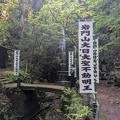
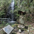
    Once off the highway we stopped at a conbini for breakfast and a second coffee and then fueled up ready for the twisties. The roads were still dry so we could enjoy the first stretches of roads with our first stop being a shrine and waterfall. The complex was a lot larger and varied than expected and we spent a bit of time wandering about. The top waterfall had a couple of chains dangling in it, presumably for monks to climb up into the waterfall for mediation.

    At a lookout on the Kisenkogen Skyline.

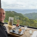
    The next stop was a lookout tower, but prior to reaching it there was another one which we quickly stopped off at for a picture, but then turned into a coffee-stop was well. I had thought the top was just a lookout, but it was a tiny restaurant and the people in it were very friendly and chatty, offered to let me take some pictures and gave me some local wild cherries. So I ordered a coffee and sat down for a few minutes. One of the ladies in the restaurant rides a 125cc super-cub and showed me a picture of her on a local rindo.

    We missed the next lookout tower – I was trying to be sneaky and went past the stairs leading up to it hoping that there would be another path to it further up the road. But the next path off the road just lead to another shrine. This one to a rain god, so I asked him not to bless us too much today!

    Sights around Koya in Wakayama.
    Sights around Koya in Wakayama.

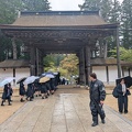
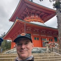
    Then it was just more stunning roads through beautiful scenery, but unfortunately the rain slowly started to come in, as Ben had predicted. We reached a town called Koya by lunchtime, where Ben had picked out a restaurant, and it turned out to be the seat of a particular sect of buddism, so there were tons of shrines and temples and impressive gate houses all over town. After lunch (katsu-don for me) we walked around a bit checking out the various sights.

    By the time we finished it was a lot later than we thought and the rain had really started to settled in, no very heavy yet, but enough to make us abandon our plans for an extended loop of roads, so we headed straight to the accommodation in a place called Dorogawa.

    Dorogawa Onsen - at our accommodation, Hot Spring Hotel Marubun.

    The accommodation, the Hot Spring Hotel Marubun, is a really nice onsen hotel and the proprietor let us park our bikes undercover in a nearby shed/garage. After checking in we had a cup of tea in our rooms and now I’m heading off to sight-see a local cave.

    As the weather was a bit meh I took an umbrella and headed out in my trusty Birkenstock’s to where Google Maps said the cave was. Ben reckoned it was a 10 minute walk or so. I took my time, checking out some local shrines, and then I got to the cave. Or rather, the bottom of the mountain! As Google had already predicted, the little monorail leading up to the cave was already closed for the day, so up up up I went, climbing the many stairs up the side of the mountain.

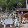
    Sights around Dorogawa Onsen - a shrine at the entrance to the limestone cave.
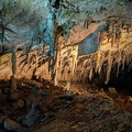
    Dorogawa Onsen - limestone cave "Menfudo Shonyudo"

    I finally reached the top, slightly out of breath, not really believing the cave would still be open, but it was. There were no more guided tours for the day, but, despite looking a bit askance at my choice of footwear, they let me buy a ticket and go into the cave.

    It was a fairly standard japanese limestone cave. On the small side, with some stalactites and stalacmites, all lit up with differently coloured lights. Due to the constant lighting and damp conditions it’s quite overgrown with mosses, which is a shame. As I got out I chatted to a girl who had also been in the cave. We ended up going into the cafeteria to get out of the storm and tried the local cider, which was very nice. She was waiting for a couple of her friends who were, presumably, making their way up the mountain in what was rapidly becoming a full-on storm.

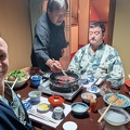
    Dorogawa Onsen - dinner at Marubun hotel.
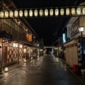
    Dorogawa Onsen - sights around town.

    I eventually excused myself and headed back down the mountain, declining the very nice offer of the cave staff to give me a ride down in the monorail. I made it back down quite a bit quicker than up, did a bit more sight-seeing around town, and headed back to our accommodation for a well-deserved onsen and dinner. After dinner we took another short stroll around town to check it out lit up with traditional lanterns.


  • Hiroshima Tour – Day 7

    From Shikoku to Awaji Island

    Hiroshima Tour Route Map - Day 7

Length: 307km, ↗7750m, ↘7905m
Time: 12:35:37h, Speed: 24.3km/h
Moving: 07:18:18h, Speed: 42km/h

Start: Thursday, 8 May 2025 07:29:21 JST
End: Thursday, 8 May 2025 20:04:58 JST
Points: 7098 (7098)

    << Previous Day | Next Day >> | Photo Album | Video

    Sunriver Oboke hotel.

    The day dawned cloudy, but it turned out to just be a layer of fog at the top of the mountains. We set off in the cool morning light and by the time we reached an overlook the sun was already starting to break through the fog layer and shortly afterwards we enjoyed bright sunshine for the rest of the day.

    As we were in the middle of nowhere there was no opportunity for our customary combini breakfast. Ben had grabbed a drink from the hotel vending machine, and I managed to bum a hot coffee from the breakfast room staff, which was enough to get me going.

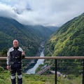
    Looking down into the Yoshino river valley near Koboke on Route 32.
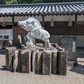
    At the statue of the peeing boy in the Iya Valley on Route 32.
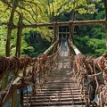
    Vine bridge over the Iya valley on Route 32.

    The plan for today was mostly just mountain roads and scenery, the various stops were primarily to set the route. Nevertheless some of the stops were interesting and/or nice, such as our first stop which was the status of the peeing boy on route 32. Ben said there was a very famous peeing boy statue in Belgium as well. The first waterfall stop also had a vine bridge, which I crossed (for 550yen) and as it had just gone 9 a nearby cafe opened. So we enjoyed a french toast for breakfast sweetened with local honey. The cafe also attracted some local finches (or something) and tourists can feed them with some sunflower seeds, which I did.

    At Nagoro, the "Scarecrow" Village
    At Nagoro, the "Scarecrow" Village

    After breakfast it was just epic road after epic road. We barely got any traffic all day and mostly followed the 439/492. One interesting place we stopped off at was the “scarecrow village” – a village with many scarecrows. A local lady started off making one in the likeness of her dad and then made more and more to make the village look more lived-in again. Later the village gained renown after a traveller posted an article about it and it went viral. Sadly many regional areas of Japan are suffering from depopulation as younger people move into the cities, leaving the older people behind.

    At a scenic spot on Route 438.

    The last spot I had picked out on the 439 was just a “scenic spot” but turned out to be a small shrine to a mountain pass god. As we were still pretty remote and it was getting on towards lunchtime I found a place on our route and, fingers crossed, it would be open unlike yesterday.. it also had some pretty good menu items listed, I was pretty keen on the grilled local fish.

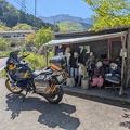
    Lunchstop in a tiny cafe which was full of locals.

It was the only place available for many miles in all directions.
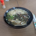
    Lunch of wild mountain vegetables with udon.

    When we got to the restaurant it was actually open, hurray! But it turned out that most of the listed menu items were from quite a few years ago. These days there was some takeaway sushi and soba or udon bowls with wild mountain vegetables, which is what we ended up having. Nevertheless it was pretty good and the lady running the place is lovely. All the other diners seemed to be locals and helped clear a table for us and offered us water.

    At Ōgama waterfall on Route 138.

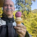
    Shortly after lunch we parted ways – I wanted to ride the 16, and Ben wanted to head to our accommodation on more main roads. I’m glad I chose the 16 – just for a change it was an epic road with no closures or dirt. Right at the start there were some nice waterfalls right next to the road and great views over the surrounding valleys. It eventually came out in Katsuura where I stopped at a little roadside station for an icecream. From here on the road was larger and smoother and I could go at a good pace, eventually getting onto the expressway to get through the urban conglomeration at the east end of the island and to get over the bridge to the next island. From the bridge I could see the whirlpools in the waters underneath, which are a local attraction. There must be some pretty strong currents between the islands.

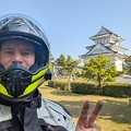
    I took the first exit from the highway and then hugged the coast to Sumoto, which was another absolutely amazing road. I had practically no traffic and made great time to the Sumoto castle ruins, where I stopped for a quick look-see. It must have been a pretty big castle in its day but these days only the massive foundations are left, although there is a replica castle tower built on the highest point. There are some great views from the top over Sumoto and the surrounding seas.

    From Sumoto it was just a run to the accommodation, but still pretty nice crossing the island through some suburbs and farmlands. People were burning off brush or grass and there was a haze of smoke everywhere. On the other side of the island the sun was just setting as I reached the accommodation. Ben arrived only a few minutes later, we checked in, then went to the beach for a burger dinner out in the open.

    What an amazing day!!


    Drive: X km

    Stay: Sakia Stay, basically an overpriced hostel, but with clean and modern individual rooms. No undercover parking for the bikes, just a big gravel parking lot.


  • Hiroshima Tour – Day 6

    Hiroshima – Shikoku

    Hiroshima Tour Route Map - Day 6

Length: 381km, ↗6565m, ↘6395m
Time: 11:00:57h, Speed: 34.6km/h
Moving: 06:43:01h, Speed: 57km/h

Start: Wednesday, 7 May 2025 06:31:23 JST
End: Wednesday, 7 May 2025 17:32:20 JST
Points: 5638 (5638)

    << Previous Day | Next Day >> | Photo Album | Video

    Views around Hiroshima.
    Innoshima Bridge lookout.

    The day dawned gorgeous and sunny. Somewhat slow getting going and getting out of Hiroshima to the breakfast-conbini was an excercise in frustration. However, we soon met up and got onto the highway to get to Shikoku Island. The highway was, apart from a brief section, relatively free of traffic and we could mostly do 100kmh. Eventually we peeled off onto the E76, the Shimanami Expressway connecting 5 of the Geiyo Islands just east of Hiroshima. Despite being a highway it was very scenic, and we stopped off at a viewpoint of one of the bridges to stretch our legs and take some pictures.

    Eventually we reached Shikoku and stopped at a conbini, where, as well as having another coffee, we chatted with a german girl called Laura who was doing the second half of a pilgrimage walk around Shikoku. Crazy! But in an awesome way. She’s mostly camping, including staying at shrines, which I didn’t even know was a thing.

    Looking back into the valley on Route 494.

    After the coffee break we headed off up the 494, also called the Ishizuchi Skyline, which is an epic ride circling the southern half of the tallest mountain on Shikoku. It starts of two-laned with great tarmac and fantastic sweeping bends but then narrows and climbs steeply up to its highest altitude of 985m through mostly pine forests, on the way giving some great views onto the surrounding valleys.

    Lunch in Cafe Okkuntoko, a tiny place in a tiny village on Route 494.

    Route 439 followed, again, absolutely stunning roads and we were very lucky to have almost no traffic. It was a bit sad to see that most of the area seems to be in a bit of a decline, with many villages looking semi-abandoned. In fact, our lunchtime stop was closed and there was nothing around for nearly an hour in every direction. We did eventually find a little cafe/restaurant in a small village called Ikegawa and had a great Nanban chicken lunch. I spoiled myself and had a custard-cream puff and a coffee for dessert.

    At Nikko Deep near Route 194.
    At Nikko Deep near Route 194.

    Of course now that we’d had lunch there were quite a few places on the continuing route. After Ikegawa the roads generally were wider and also a little bit busier. Our next stop was a Nikobuchi, a very deep rock pool fed by a waterfall. Very stunning. I was very tempted to go for a swim, but firstly we did not have that much time and secondly it’s not allowed as the pool is considered sacred.

    A foot bridge across the Yoshino River on Route 194.

    This was pretty much our last planned stop for the day, now it was just a stretch to our accommodation in Oboke Gorge. Enroute we passed a large reservoir and when I spotted a small suspension bridge over it I parted ways with Ben, did a quick U-turn, and went back for a couple of pictures. I then tried to catch up again, but after doing some mental arithmetic, I gave up, figuring the 10 minutes spent at the bridge during which time Ben was doing 50-60kmh would have given him too much of a lead. So I continued on, stopping for petrol, and eventually got to our hotel, the Sunriver Oboke onsen hotel. Again, the roads and scenery leading up to it were just breathtaking. This area must get even more picturesque during autumn!

    Dinner in the restaurant of the Sun River Oboke hotel.

    While checking in I asked if my friend had already arrived, and just as I did I got a message from him – he was still 40 minutes or so away and was just taking a breather. So I hopped into the onsen to wait for him before dinner. By the time I finished with onsen Ben had arrived, so we went down to have dinner at the hotel restaurant. While the hotel is very nice, the restaurant was offering up fairly standard meals at surprisingly affordable prices. I ended up having a tonkatsu set meal which wasn’t anything special but something I always enjoy.

    Now it’s time for second onsen, and bed. Oyasumi!


    Drive: X km

    Stay: Sunriver Oboke onsen hotel; no undercover parking for the bikes, but set very nicely in Oboke gorge next to the river and a railway bridge. Very picturesque view from the window, and a nice onsen and sauna.


  • Hiroshima Tour – Day 5

    Yunogo Onsen to Hiroshima

    Hiroshima Tour Route Map - Day 5

Length: 305km, ↗6840m, ↘6910m
Time: 09:04:42h, Speed: 33.7km/h
Moving: 05:43:49h, Speed: 53km/h

Start: Tuesday, 6 May 2025 06:51:51 JST
End: Tuesday, 6 May 2025 15:56:33 JST
Points: 4897 (4897)

    << Previous Day | Next Day >> | Photo Album | Video

    As Ben had predicted, the day dawned with heavy rain, which petered off a bit by 6am. But as we had pre-booked all of our accommodation, there was no changing of plans. So we got dressed in our wet weather gear and set off into the grey dawn..

    At the Hayama 2nd tunnel on Route 300.

    We headed off to our first waypoint, a natural-hewn rock tunnel. Part-way there we split up as my GPS showed me a nice windy way and Ben wanted to stay on main roads in the rainy conditions. I should have stuck with Ben – the road I took got _very_ rural and the forks it wanted me to take led to several closed roads. In the end I ended up back on the main road where I tried to make good time to catch up with Ben. I never saw him and eventually ended up at the rock tunnel shortly after 9am, our agreed-upon meeting time.

    I spent half an hour or so there, chatting to some rock climbers and another biker who turned up, but eventually decided to head off as Ben still hadn’t turned up and I had no signal. Our arrangement was that the we’d wait for a bit at the tunnel, then head off to the next combini to wait somewhere dry. Turns out Ben had stopped to warm up a bit and then decided to wait at his stop for a message from me before continuing on. So… back to the rock tunnel I went to try to meet him there again, and this time he turned up a few minutes after I got there.

    As I had already seen the tunnel and surrounding area I explored a cave for a bit – it went in surprisingly far and after the initial crouch opened into a rather large passage with several bats roosting on the ceiling. Pretty nifty, although no stalactites – either the cave is too new, or no water can seep down. By now the weather had finally cleared a bit and the heavy rain petered out to a drizzle and then turned dry.

    Ramen Lunch
    Ramen Lunch

    We set off again, this time following Ben’s GPS to avoid the tiny road which mine insisted to follow and soon were on the main roads. Not long after it guided us onto a tiny road though, so I took over, guided us past a very large dam and reservoir, and eventually we came out near a highway. We had a great ramen lunch, then jumped on the highway to Hiroshima. Boring but effective.

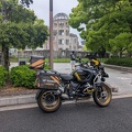
    Hiroshima Bomb Dome memorial

    Once in Hiroshima we did a quick photoshoot of the Bomb Dome with the bikes before checking in to the hotel – just as it started pouring down rain again. Oh well, with a couple of umbrellas borrowed from the hotel we wandered off through town for some sight-seeing, but as I had already done the museum several years ago, I decided to head back to the hotel and warm up and meet with Ben again later for dinner.

    Hiroshima style okonomiyaki for dinner.
    Views around Hiroshima.

    We met up for dinner in an okonomiyaki restaurant, which was full of foreigners. Guess we found all the tourists! Dinner was quite nice, after which Ben headed back to the hotel and I wandered around Hiroshima for a bit checking out the lit up streets. On the way back to the hotel I saw a cheap Thai massage place and decided to spoil myself.


    Ride: X km

    Stay: Oriental Hotel Hiroshima, no bike parking (but paid parking across the road); basically an upmarket business hotel.


  • Hiroshima Tour – Day 4

    Kaemoka (Kyoto) to Yunogo Onsen

    Hiroshima Tour Route Map - Day 4

Length: 227km, ↗4150m, ↘4185m
Time: 09:48:24h, Speed: 23.2km/h
Moving: 05:08:22h, Speed: 44km/h

Start: Monday, 5 May 2025 06:41:11 JST
End: Monday, 5 May 2025 16:29:35 JST
Points: 4328 (4328)

    << Previous Day | Next Day >> | Photo Album | Video

    Up fairly early to a bright sunny morning. After packing our bikes we set off towards our first waypoint, a shrine in a nearby town.

    Obligatory combini breakfast stop.
    Ikimi Tenmangu Shrine
    I bought a "Fair Sailing" charm for good weather at the Ikimi Tenmangu Shrine. Let's hope it works..

    Just before the shrine we stopped at a combini for breakfast and a coffee – our standard start of the day as there’s very little else open at this time of the morning in Japan. Caffeinated up we reached the shrine, took a couple of pics, and wandered about. A rather enthusiastic monk in torn gloves welcomed us despite the early hour and gave us various bits of information. In the end we bought a couple of blessed artifacts – Ben for general good luck, and myself one for good weather and and fair sailing. The complex also had a shrine to a goddess of beauty where I stopped off at. Too late for me, but maybe it will help someone else..

    Replica of Sonobe Castle in Nantan.

    After the shrine we drove past the local castle which had, unfortunately, had some major modern rework done to it. It was also surrounded on most sides by modern buildings, so wasn’t very picturesque. Anyway, onwards! We headed off on the 479 (?) which turned into a single-track forest road with a fair bit of gravel and debris after we left town, but opened up on a rather nice stretch of windy road after the pass. I guess different prefectures, different levels of maintenance?

    At Ikuno Silver mine.
    At Ikuno Silver mine.
    At Ikuno Silver mine.

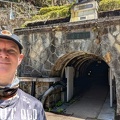
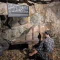
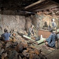
    Our next stop was a silver mine just past a rather nice dam. It was interesting touring the public part of the mine and seeing the evolution of mining techniques from hammer and chisel and narrow crawl holes to pneumatic drills to blasting and finally open-cut mining. After the tour we had a nice lunch at the mine complex as there was nothing else nearby and it was surprisingly good food despite the cafeteria-like setting.

    At the ruins of an old ore processing plant.

    We set off again on some nice roads and our next weypoints were a small cast-iron bridge, which we skipped, and the abandoned workings of an ore processing plant. I originally thought it was a hydroelectric power station when I planned the route, then thought it might have been a sewage works based on a (in japanese-only) information tablet on-site, but then found out the real purpose from a nearby street sign. It was quite impressive and gave me vibes of Horizon Zero Dawn.

    We then had a long ride to our final destination and a lot of it was rather uninspiring. Still, the road was in great condition with very little traffic so no complaints.

    Toy museum in Yunogo.
    Toy museum in Yunogo.

    Once we reached Yunogo Onsen our first stop was at a little toy museum Ben had found out about online, which had a rather esoteric collection of toys of all ages and a pretty big model train layout in N-scale. As we left the museum there was a family checking out my bike so I offered to let the kids sit on it. Cute.

    In Yunogo Onsen.
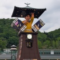
    In Yunogo Onsen - animated clock tower.

    Our accommodation was only a few minutes away and after a quick onsen we were off to see the animated clock which Ben had read up about. On the way we saw a matsuri ostensibly being held for the local girls soccer club.

    In Yunogo Onsen - local festival promoting the local girls soccer team.
    In Yunogo Onsen - dinner in a traditional izakaya.

    After watching the animated clock we wandered back to the matsuri, but then decided to eat dinner in a nearby izakaya instead as we wanted to sit down. Old men are funny like that.. We had a rather standard izakaya dinner, now it’s back to the hotel for onsen and bed, Tomorrow we’re off to the tour destination – Hiroshima!


    Drive: X km

    Facilities: Yunogo Onsen hotel “Katsuragi”. We stayed in the annex, very modern and clean, but basic and a surprisingly long walk from the main hotel entrance. Could use facilities in main hotel, which has a nice onsen. Staff was very friendly. There was no undercover parking for the motorcycles, but they let us park in front of entrance on paving instead of the gravel parking lot.


  • Hiroshima Tour – Day 3

    Gujo Hachiman to Kameoka (Kyoto)

    Hiroshima Tour Route Map - Day 3

Length: 342km, ↗6135m, ↘6255m
Time: 12:12:41h, Speed: 28.0km/h
Moving: 07:24:15h, Speed: 46km/h

Start: Sunday, 4 May 2025 07:11:43 JST
End: Sunday, 4 May 2025 19:24:24 JST
Points: 6794 (6794)

    << Previous Day | Next Day >> | Photo Album | Video

    Up not quite as early as recent days. Had a somewhat poor sleep despite the sound of the river – the futon was a bit hard, and Ben snored a fair bit.

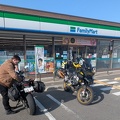
    The day dawned a bit grey, so we skipped walking through town as originally planned. Instead we stopped at a Family Mart for a quick brekky and then hit the road. Oh, and what a road! The first hour or two was just amazing, fantastic road, nice scenery, luvverly!

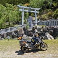
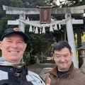
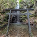
    This set the tone for the day – mostly just amazing roads and views along the 477, which we followed for most of the day, skipping only some sections. We visited a waterfall which involved a bit of a scramble up a steep forest path followed by a stroll to the main waterfall, which had a tori-gate set up in front of it as well as a small shrine. It was rather nice.

    We took the expressway for 100km or so to skip the urban conglomeration of Nagoya and got some great views of the harbour bridges. But overall boring as heck and a little bit strenuous as we had very strong winds.

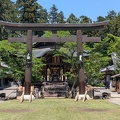
    Once off the expressway we had another awesome section of road. Our next stop was a shrine which was just off the main road. In fact, we had to follow a very tiny side-road to get there, but it was well worth it. There were several people about setting up for some sort of event, with plate-jugglers and everything. But apart from them there were no other tourists around so we could explore the grounds in peace.

    We wanted to have lunch at a local beef place as the area is renowned for it, but the queue was quite long. After waiting 20 minutes or so we gave up and had lunch at Mos Burger instead. A bit boring, but it got us going again. Many more great roads followed along with a visit to a small forest shrine.

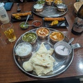
    We finally reached the hotel and opted for a second room after having had shared accommodation for the last few nights. Then it was off to dinner at an indian restaurant not too far away.

    Time for bed..


  • Hiroshima Tour – Day 2

    Suwa to Gujo Hachiman

    Hiroshima Tour Route Map - Day 2


Length: 298km, ↗6525m, ↘7060m
Time: 10:43:31h, Speed: 27.7km/h
Moving: 06:19:51h, Speed: 47km/h

Start: Saturday, 3 May 2025 06:00:24 JST
End: Saturday, 3 May 2025 16:43:55 JST
Points: 5188 (5188)

    << Previous Day | Next Day >> | Photo Album | Video

    Up bright and early for a blast around the Venus Line before starting the day proper. It had cleared up overnight and while many roads were still damp, it was mostly dry now. There was still quite a bit of cloud cover about, but we climbed up and out of it into glorious sunshine and fantastic views of snow-tipped mountains poking out of the clouds in the distance.

    Our first stop was Narai Juku, an Edo-period town that formed an important waypoint between Kyoto and ???. These days the government helps to pay for the upkeep of the traditional houses. Apart from one or two more modern houses, the main street looks fantastic and having gotten there quite early it was not so crowded. The town was also preparing for a local oiwei (festival) for tomorrow and people were busy putting up bunting and lanterns. We tried some traditional fried dumplings while walking around. After climbing up into the forest above the town to view the ruins of some family house (all that was left were some earthworks and a plaque..) it was almost lunchtime – so we had a curry-rice cooked after a 100-year-old recipe.

    As we were concerned about the level of traffic on the main roads we reworked our onwards route onto more minor and windy roads. It turned out that we had not quite synced up as we ended up on a road which was blocked – something which Ben’s Google Maps shows, but my navi doesn’t.. so a bit more recalculations later and we were headed down another not-so-major road past a massive dam to reach our final destination – Gujo Hachiman. Due to all the route rejigging we ended up skipping the remaining waypoints which were originally planned for today. We also got to Gujo Hachiman much later than I had originally planned for – so no visiting the castle.

    After checking in to our minshuku – which was way better than I had expected – we headed out to look around town. But first off to book a table for dinner at a restaurant which got recommended to us – and Ben had already shortlisted anyway. Unfortunately the restaurant couldn’t make a booking for us as they were full up for tonight.. but they did have space right now if we wanted it. So sacrificing some of the remaining daylight we had an early dinner of 2 different kinds of cooked chicken – a specialty of town. The one I chose was the one recommended by the proprietor and had some crispy garlic in the sauce, very delicious.

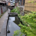
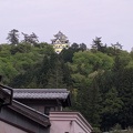
    Following on from dinner we headed to Ben’s primary objective – a small waterway filled with koi. Overall the town has a lot of water flowing through it, there’s 2 rivers which join up at one end of town and plenty of artificial small waterways and streams. It’s extremely picturesque! I wanted to take a look at the castle and, after a roundabout walk we reached the road leading up to it – at which point Ben decided that he wasn’t really up for that much of a hike. So we split ways and I started up the mountain – taking some stairs through a temple as a shortcut and ending up on some rather unorthodox little paths through the forest shortcutting the road winding its way up to the castle.
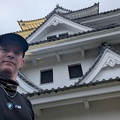
    I made it to the top with a tiny vestige of daylight remaining and took some pictures of the castle. There were some amazing viewpoints over the town and valley from the top too! I made my way around the back of the castle, poked about a bit since nobody was around anymore, and finally headed back down to town, this time by more orthodox roadways and paths..

    At the minshuku I had a quick bath and now it’s time for bed.. fantastic falling asleep listening to the sound of rushing water (and Ben’s snoring..)


  • Hiroshima Tour – Day 1

    Tokyo to Suwa

    Hiroshima Tour - Route Map Day 1

Length: 377km, ↗7805m, ↘6950m
Time: 11:54:18h, Speed: 31.7km/h
Moving: 07:02:43h, Speed: 54km/h

Start: Friday, 2 May 2025 05:48:36 JST
End: Friday, 2 May 2025 17:42:54 JST
Points: 5836 (5836)

    << Previous Day | Next Day >> | Photo Album | Video

    Up early, and a very good run down the highway to Dangozaka SA on the E20 where I met up with Ben. Another hour on the highway to Hokuto where we got off to take the 141 north. After a quick combini stop it was off to play on the local roads.

    We made our way up towards Tateshina, but then took some very tiny and twisty local roads across to the 40, which we then took back down south to Shirakaba lake where we were only last weekend.. it’s a small world!

    We had a ramen lunch to warm up after which Ben headed off to our hotel in Okaya and I went off to explore the Venus line and other roads in the area in the cold and rain. Despite the miserable conditions I quite enjoyed the ride up and back down, with the bike reaching the Schnappszahl 22222 km.. Unfortunately it was so foggy and rainy that there was absolutely no view from the top. At 1995m altitude it was raining and 5C… brr!

    Due to various road closures I ended up back on the 142 to get to the hotel – and the last half was absolutely frustrating following a very long queue of cars at 30-40kmh. But overall it was a good run and my confidence riding this bike in the rain increased a lot.

    Finally at the hotel, first thing after check-in was a hot bath. My gear had kept me partially dry which is pretty good considering the conditions. The boots, unfortunately, proved to be not quite as waterproof as advertised.. Also, the nature of the gear means that the outer layers get completely soaked as the waterproofs are on the inside.

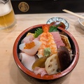
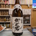
    After the bath, Ben and I met up for dinner. After a few false starts we found a great local sushi place where we had the seafood bowls “chirashi”, some hot soup, and I had some local nihonshu (sake).

    Time for bed – tomorrow we’re planning to leave quite early for a run around the the Venus line before doing the rest of the planned tour. But first, some drying of gear with the hair dryer..

    All up a successful, albeit cool and damp, start to the tour!


  • Dragon Tour – Day 1 of 4 – Tokyo to Matsumoto

    (Pictures and/or video will come later, so check back in a week or two..)

    Up quite early to get going as I wanted to beat the traffic. I had already packed the bike the night before, so it was just getting geared up and go. I followed the same route out of Tokyo as last weekend as we were going to meet up again at the Miyoshi PA.

    I arrived well ahead of schedule, grabbed a coffee, and chilled. Wilson was next to arrive, and not long after Ben showed up as well. We briefly discussed the first part of the ride and then set off. As feared, the highway was already pretty chockers by now but, being a small group, we filtered through the worst of it and were soon at our exit and heading down the 299.

    The first part of the 299 is nice, good quality road with sweeping bends, but with heavy traffic and no real overtaking opportunities, making progress slow. I took the guys on a small detour to go past Bike Bento, a motorcycle-themed restaurant, but it was still closed so we didn’t stop.

    We kept going up the 299, sometimes wide with sweeping bends, other times almost one-lane twisting through forests, and finally up and over the mountains. At one stage there was still lots of snow beside the road and under the trees, epic.

    When we reached an intersection on top of a mountain I stopped to take a picture of the view and there happened to be a small diner there as well, so perfect timing for lunch. Wilson and I had the local specialty, katsudon with a special sauce. It was pretty good.

    The top of the mountain was the middle of a section of the 299 called the Märchen Road – german for “the road of fairytales”, and it really looked like it. Pine forests, moss-covered boulders, little huts nestled amongst the trees, snow and ice. I will need to come back in a few months when the path to the Mononoke Forest is open again.

    We kept following the 299 back down the mountains and turned off onto the 192, one of the many sections of the Venus Line, an amazing set of roads over sparsely forested mountains leading to some fantastic views. At the end of this section is Lake Suwa, where I had an ice-cream and we stretched our legs.

    Wilson decided instead of continuing on with us to Matsumoto that he would head back to Tokyo after all, as it was still fairly early. He would come to regret this decision later as he got caught in a big thunderstorm while we enjoyed a cold beer in an izakaya …

    Ben and I continued on towards Matsumoto ,enjoying some more amazing roads before getting into town. Once there we headed straight to Matsumoto castle, parked the bikes nearby for 100 yen, and went in. The price has nearly doubled since I was there last when I paid 700 yen entry, now it’s 1300 yen! Still, I couldn’t even remember I’d been there until I accidentally found the entry ticket while packing for this trip, so it was still fun to visit again.

    Matsumoto castle is one of, if not the, oldest castle in Japan, having been built sometime in the 1500’s. Unfortunately it was pretty crowded despite it being quite late in the afternoon, so it was more of a very long moving line instead of being able to explore and experience it properly. But it has some medieval gun exhibit and other bits and pieces dotted throughout it. It’s well worth a visit if you’re in the area.

    After the castle we rode to the minshuku and checked in, then walked to town for an izakaya dinner where I ordered the local specialty, chicken pieces marinated in a garlic and soy sauce before being deep-fried. I also enjoyed some basashi (horse-sashimi) as well as some other more standard izakaya fare.

    After dinner we walked to the castle to take some night-time pics, and then headed back to minshuku for a quick onsen before bed.

    We had a fantastic day to start our tour!