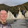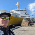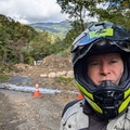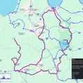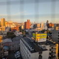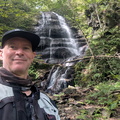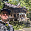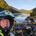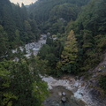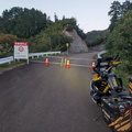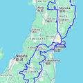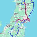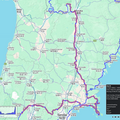
• Long weekend motorbike trip to Nagano

    Day 1 – Saturday 10th of October, Tokyo to Nagano
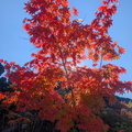
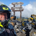
    This was originally supposed to be a diving weekend to Hachijojima, but due to some typhoons this got cancelled. My next idea was just to have a quiet one at home, cleaning up, and playing computer games. But the weather turned out to be fantastic, and my buddy Ben had decided to head up to Nagano to see if there were some early autumn leaves out.

    Despite a bit of a heavy week I decided at the last second to join him, booked a hotel, and headed out to catch up with him on Saturday morning. The first half of the day I did my own thing, checking out a couple of sights along the way which I hadn’t stopped at before.
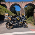
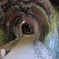
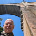
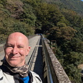
    The first of these was the Usui Pass 3rd Bridge, or Megane Bashi, an abandoned red-brick railway bridge built in 1892. I had ridden past it before, but never stopped. These days it is not only a great photo opportunity, but you can actually go up onto it. Quite a large section of the old railway has been converted into a hiking trail which goes over the old bridges and through the old tunnels, past abandoned stations, and with fantastic views over the surrounding countryside.
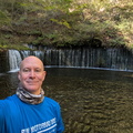
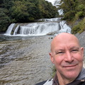
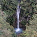
    Next was the Shiraito waterfall. This is along a toll road, which is probably why I always skipped this previously. Turns out it is well worth a stop as the waterfall seeps out from a layer of porous ground above a water-impervious layer, rather than simply being a river, so it is quite a unique sight despite only being a few meters high.
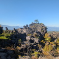
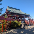
    From there I headed up to the Onioshidashi Volcanic Park which I had visited previously with mum, but Ben had stopped there for lunch and a drone photo-shoot, so I could finally catch up to him. We had a bit of a wander through the park which has some amazing rock formations, glowing moss, and a nice temple built atop it all. The name of the lava flow, which occurred in 1783 means “expelling daemons”, and the tourist shop sells lots of Oni figurines.
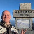
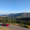
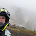
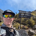
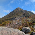
    We didn’t really have any other specific stops from here on, but had an amazing set of roads, especially up and over Mt Shirane. The road we took has been closed a lot due to volcanic gases, but today it was open and we got a good view of an active section of venting on top of the volcano. These roads also go over the highest navigable
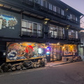
    Our evening stop was in Yudanaka, me in the Snow Monkey Lodge hostel, and Ben in a nearby hotel. The hostel is really welcoming and has great facilities, even a little onsen. But before we could meet up for dinner I got a call from Ben – he’d lost one of his saddlebags on the way down the mountains! So off we went in the dark to try to find it, retracing nearly 30km of windy mountain road and, incredibly, there it was on the side of the road! A passing vehicle must have stopped and propped it up. Amazingly there was barely any damage.

    Back in Yudanaka we had a nice dinner at a local Izakaya, then onsen and bed – it was a long day!

    Day 2 – Sunday 11th of October – Nagano to Suwa
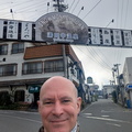
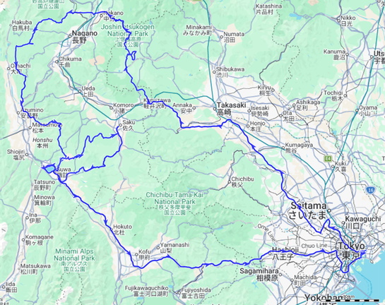
    Today we had a lot less on – mostly just making our way to the Venus Line, an amazing set of roads around Mt Kirigamine, and enjoying the scenery along the way.

    We got started quite a lot later than we planned, met up at a local kombini for a coffee and a quick bite to eat, and then set off just as the fogs started to lift off the mountains. Overall the day was a bit frustrating as there was a LOT of traffic, especially over the Venus line, making progress a lot slower than expected.
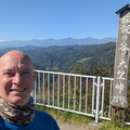
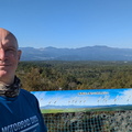
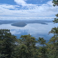
    One of the best spots we stopped off at was a tiny little lookout not far out of Nagano giving an impressive view over the mountain ranges in the area. While it was a waypoint on our route, it was mainly set to force the route over a particular road, with no particular expectations.
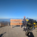
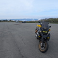
    The other main spot we stopped off at Utsiushigahara Open Air Musem. While we didn’t care much for the actual museum part, which mainly consists of large art sculptures dotted around the landscape, the parking lot has a fantastic view over the surrounding landscape.

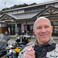
    For lunch we stopped at a roadside area which Ben had been to before and recommended the soba which turned out to be pretty good.
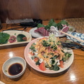
    Heading down from Mt Kirigamine we split up, Ben heading to his hotel, and me heading to meet up with Julie, and old friend and diving buddy of mine, who lives at Lake Suwa these days. Unfortunately it was a bit late by the time I got there to take her for a ride, so instead of meeting up with Ben again for the ride back to Tokyo, we made a plan for a ride-out instead.

    Day 3 – Monday October 12, ride-out and back to Tokyo

    As Julie had never been on a motorbike before, we first did a small loop of Lake Suwa, to see if she liked it at all, which she did! We then went up the Venus line to Lake Shirakaba, which is one of my favourite stops for an ice-cream, giving us fantastic views over the countryside along the way.
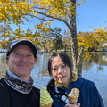
    As Julie was happy to keep riding, I planned a loop along the 482 to Saku, and then back to Lake Suwa along the very picturesque 299, also knows as the Märchenstraße (road of fairy-tales). As well as being very beautiful, the road is also mostly a great motorbiking route.

    The 482, despite being classed as a major national route, turned out to be an incredibly bumpy and poorly maintained single-track road winding its way through forests and, for part of it, farmland. I hadn’t done the first part of it before, but when we reached the farmland I recognised it, but by then we were most of the way to Saku, so there was no point looking for an alternative at that stage.

    The 482 had taken far more time than I had anticipated, and we got to Saku a lot later than planned. We had a late lunch at an italian restaurant, where I had spaghetti puttanesca, which was very nice despite a distinct lack of anchovies..

    I also got a big shock – Ben had sent a text saying he’d crashed his bike and hurt his shoulder. Despite that he was making his way back to Tokyo as there was only minor damage to the bike and he could manage.

    Then it was back on the road and the 299 more than made up for the 482, with nice tarmac, few cars, and gorgeous scenery. I had wanted to stop off at the “Mononoke Forest” for a little hike, but unfortunately it was getting a bit late in the day.

    I dropped Julie off at her house and in the meantime Ben had made it home and was heading to the hospital for a checkup. But he asked me if I could drop in on his house on the way home to help him park up the bike.

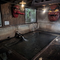
    To avoid the rush-hour traffic home, I stopped off at a roman-style onsen, which is a much deeper bath than a normal onsen, and relaxed my tired muscles for an hour or so before the long dark ride back to Tokyo. Originally I had wanted to take some nice roads home, but as it was already dark I just jumped on the highway and, as planned, it was mostly clear riding all the way.

    When I got to Ben’s place it turned out he’s got a multiple fracture of his collar bone. Ouch! And he still rode his bike home! I helped him park up his bike, told him to call if he needed anything else, and finally got home around midnight.
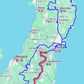
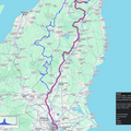
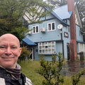
  • Silver Week 2026 – Day 10

    Zao to Tokyo

    Weather: rain and heavy clouds with intermittent sun. 15C in the morning, with a high of 24C in Tokyo.
    Distance: ~490km

    << Previous Day | Next Day >> | Photo Album | Video

    Today was a day of epic roads, mostly spoiled by rain and/or slow cars and some unexpected highlights.

    Woke up early to rainy weather. As it was still some time to breakfast, I uploaded some photos to my albums. I asked for a smaller breakfast, but it was still more than enough food, and very delicious. As the rain didn’t let up as predicted I finally left around 8:30 and decided that I was going to do my planned roads after all despite the miserable weather.

    First up was the Zao Echo Line, a fantastic and very scenic road curving up and over the Zao mountains. I’d ridden it before in the other direction, and I was hoping to take a bit more time this time around and stop at some waterfalls and views. But there was nothing to see due to rain and fog – at least, not until I got over the other side when the clouds lifted, the rain stopped, and there was a bit of a view.

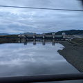
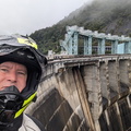
    I had originally planned to do the 399 heading south, but at the last minute switched it to the 13/133 instead which, as it turned out, I had ridden before. I didn’t realise until I got to the Shichikashuku Dam which looked strangely familiar..  I guess there was a reason I had planned to do the 399 instead lol. On the way I also stopped for a quick break for an ice-cream, and a nice surprise was that the place I had stopped at was also the location of the … waterfall! If From there I went and rode the Bandai Azuma Skyline which, like the Zao Echo Line, was mostly wrapped in thick fog and some rain which is a shame, as this road leads through some amazing volcanic terrain and I was hoping to get a different view of it going the other way. I guess I’ll have to come back someday.

    From here my plan was to head back to Tokyo on the highways, but the weather was finally clearing a bit and, due to not really stopping anywhere, I was still pretty early in the day. So a brief cafe-break at a 7-11 had me decide to go to a waterfall, which was also marked as a BMW Mileage Rally waypoint. Turning out of the parking lot I was stuck behind a huge queue of cars, trucks, and other bikes, so a brief check of the GPS showed a couple of regional roads leading roughly in the right direction, so I peeled off the main road (much to the dismay of my GPS) and ended up having the best part of the day, leading through some really nice rural areas and great little roads with little to no traffic, especially as the sun was making a bit of a break through the clouds as well.

    The waterfall stop turned out to be an overlook quite far away from the waterfall, which still looked impressive even from this distance. I have no idea whether it’s possible to reach the base of the waterfall, but it would be a pretty lengthy hike. As a hidden bonus I saw a sign for an onsen, and, grabbing a towel, I walked the 400m or so to get to it (no vehicle access). This turned out to be a real hidden gem, a very traditional rambling place, half museum, half onsen, set deep in the forest next to a river. I enjoyed a good hot soak and a bit of a chat with another visitor, Tatsua-san, from Utsunomiya.

    In the gathering dark I jumped back on the bike, headed out of the forest, and did the last 200km or so back home on the highway. Apart from one slowdown due to an accident, traffic flowed very well and I mostly cruised between 100-120kmh, so ended up home just after 20:00. A bit of a mixed-bag of a day, some early disappointments, but also some nice roads and a fantastic end to the trip!


  • Silver Week 2026 – Day 9

    Ryusendo (Iwata) to Zao

    Weather: heavy clouds all day with some showers. 15C in the morning, with a high of 21C during the day but mostly cooler.
    Distance: ~400km

    << Previous Day | Next Day >> | Photo Album | Video

    Today was a day of mostly following the 45 along the east coast..

    Woke up later around 6:30, then had a huge breakfast and was finally ready to leave by around 8am. It was pretty fresh heading off to the coast, where I picked up the start of the 45. The GPS kept trying to push me onto the E45, but what’s the point of a motorcycle tour if you just sit on the highway between stops. The point is to ride cool roads.

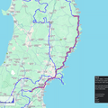
    Overall the 45 is a very mixed bag – long slow stretches following cars with yellow lines, but also the occasional faster stretches with nice curves and views. All up it was rather sobering to be riding along the coastline which had been devastated by the tsunami. The entire coast is now huddled behind a 14m high concrete wall and it’s impossible to see the ocean unless one is up on a hill. I guess everybody feels better this way, especially with the devastation still such a recent memory. But as an outsider it is difficult to understand, it seems to me it would be better to rebuild the towns higher up in the hills and leave the coast for farmland with the risk that it might get inundated once every 50-100 years or so. The way the coast is wrapped in concrete is very ugly to me and I can’t see many people coming to visit these places anymore.

    But for the people who live with the memory of this disaster, and seeing all the empty places where once houses and villages stood, I guess it is not such a high price to pay.

    Unfortunately I made a few poor choices with my stops today.. I went to see a few coastal highlights such as interesting rock formations, but overall they weren’t all that spectacular.. and while I did stop at a small tsunami memorial, for some reason I had neglected to put the big one on my route for today. In retrospect that would have been a far better stop.

    One place which I did not regret going to is a daibutsu, a giant buddha statue overlooking the coast. Always quite impressive and I didn’t realize that Japan has so many of these dotted around all over the place.

    Overall it was a bit of a rushed day as I had quite a lot of distance to cover, and I did not want to do it on the highways. At the end of the day it was quite good that I didn’t stop too often since I got to the property just as it was getting dark. Even though it was still well before sundown, the heavy clouds made it much darker than it should have been.

    The place I sopped for the night, Dari Pension, is run by a guy who has accumulated a pretty impressive whiskey collection – over 800 bottles! After onsen and dinner I sat down and tried a couple, chatting with the owner as good as I could with my broken japanese and lots of Google Translate..


  • Silver Week 2026 – Day 8

    Oma to Ryusendo

    Weather: mostly sunny to heavy overcast.  Low of 14C in the morning, brief high of 22C, then cooler again.
    Distance: 360km

    << Previous Day | Next Day >> | Photo Album | Video

    Today was a day of a lot of great roads, unexpected highlights, and caves.

    Woke up before 6am, got ready, and left to a mostly sunny morning. First stop was the top of the cape, which was almost deserted, so I managed to get a nice pic of my bike in front of the statues. From there I had decided to detour over the mountains to visit a lookout I had spotted the day before. Picking a slightly different road to the one suggested by the GPS got me to a spot where I smelled sulphur in the forest, and, sure enough, a few corners further on was a bare patch of ground with some steam rising from it.

    This turned out to be my first unexpected highlight of the day. There is a temple on top of the mountain, the Orosezan Bodaji, which is built right on top of the last remaining heat on this mostly extinct volcano. Surprisingly it was already open for visitors at shortly past 7am! Apart from it being quite a nice temple the entrance fee also lets visitors wander amongst some small fumaroles. Oddly enough a lot of them were surrounded by stacked piles of rocks with dozens of brightly coloured plastic windwheels stuck i them.. I had been meaning to find something volcanic so this was a very welcome, if somewhat unexpected, fulfillment.

    From there it was on to the observatory, but part-way along the access road a gate blocked my way. Nothing for it but to turn back, When I got to the junction with the main road, a couple of workers had just pulled up. I briefly asked them about the closed road and they said the observatory doesn’t open until 8:30.. so it was either wait, or skip it. I chose the latter as I was sick of arriving at my destinations after dark..

    From there I enjoyed a lot of great roads, mostly through farmland. At one stage I was following Route 45, and decided to actually follow its full loop rather than take the GPS-suggested shortcut, and to my surprise, the 45 suddenly turned into a little farm gravel road, which then petered out even more into a very overgrown track, at which point I decided that I had had enough of dirt roads which then end up blocked, and turned back.

    My next waypoint was the Amber Museum, or so I thought. It turned out to be a ramen shop, which I presumably had picked just for the routing, and I arrived there at the same time as the owner who looked at me rather amusedly as they unlocked the shop.. It was too early for lunch anyway, so I kept going. Quite a bit further on was the Amber museum, which was alright. They even had some information in english, and covered a little bit of the history of amber. Turns out the amber found in Japan is amongst the oldest, dating back to 85million years ago, well into the age of dinosaurs.

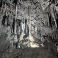
    Not much further down the road was Akkado Cave, well worth a visit! This was my second unexpected highlight. It’s nowhere near as famous as nearby Ryusendo Cave, but I almost liked it more as it was a more natural experience with limited infrastructure and even a couple of side-tunnels which are completely unlit and which you’re still allowed to crawl into. This cave is also Japan’s longest at 23.6km deep, although only the first 500m are developed and open to the pubic. Apparently there is an 8-hour guided tour into the depths.. Had a nice little chat with the proprietor, I think he was a bit bored and just wanted someone to talk to. I guess not so many people go there overall, certainly not many on a Friday afternoon!

    Finally I headed to Ryusendo Onsen, my hotel for the night, where I also got a ticket to Ryusendo Cave. I quickly dashed to the cave, and wow, completely different experience but also extremely worthwhile as there is an underground river flowing along most of the pulic area, as well as 3 underground lakes with lights suspended in their depths. The ticket is also good for the “science cave” across the road. Before the river cut through the gorge it was a single cave system. The science cave is definitely also worth a visit – while the “science” bit is a bit dated, the cave itself has much better stalactites than the main cave, although doesn’t come anywhere near the scale of it,

    Finally back to the hotel for onsen and dinner. Secondlast day tomorrow..


    PiwigoPress shortcode attribute "id" is invalid: id 'size=sq' is not a positive number
    More blurb…


  • Silver Week 2026 – Day 7

    Aomori to Oma

    Weather: mostly sunny with some clouds; later afternoon storm.
     Low of 19C or so, high of 25C.
    Distance: 364km

    << Previous Day | Next Day >> | Photo Album | Video

    Today was a day of epic roads and some backtracking..

    Woke up before 6am, but didn’t get going until after 7am. I was semi-thinking of eating the Aomori nokke-don for breakfast but wasn’t really hungry, and then seeing the ferry museum. But it doesn’t open until 9am and the weather was nice, so I wanted to get going.. so instead of waiting for it to open, I just went and took a look from the outside and then headed off.

    I had picked “the Spot where Sergeant Goto was found”, apparently a famous soldier from the area who nearly died in a disastrous winter march in the early 20th century. The road leading up to the spot was epic, but trying to get to the actual spot turned out to be futile..  As has happened to me so many times before on this particular trip, the road turned to gravel and there was a sign saying it was closed in 6km. Well, the spot was roughly 6km away, so I figured I could still visit the spot and then turn back again if I really couldn’t get through. Well, except the road was most definitely closed about 500m before the spot. There wasn’t even a way to hike the last 500m..

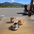
    Backtracking, I at least found a cafe with coffee and a cream bun as a consolation prize..

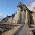
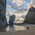
    I eventually got back onto my planned route and went along it, mostly following the coastline. I had one or two nice stops, the most memorable being the Hotoke-ga-ura Rock Formations. Despite needing to trek down several hundred meters these were well worth the effort with some spectacular views, especially when the late afternoon sun managed to break through the clouds!

    Then it was a bit of a rush to get to my final destination in Oma before sundown.. earlier in the day I was supposed to get there by 1pm or so, and now I’m rushing to make it by 6pm Story of this trip! I dodged a heavy rainstorm and safely made it to Oma just before dark. A bit of kefuffling with the codes and I got to my room. Despite being a techie, I must say I very much dislike these automated “hotels”, this one being just a private house turned into a bedsit.

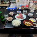
    A quick shower, and then I was off to find some of the famous Oma tuna. The most highly recommended shop in the local area, apart from the fishing wharf early in the morning, is Umaiya, and it turned out to be a delightful little Izakaya. I enjoyed quite a bit of tuna and had a trial-set of Aomori nihonshu which was a rather nice accompaniment.


  • Silver Week 2026 – Day 6

    Sight-seeing around Aomori

    Weather: mostly sunny with some periods of heavy cloud.  Low of 14C in the morning, middle of the day was 25C, then 16C in the evening.
    Distance: 430km

    << Previous Day | Next Day >> | Photo Album | Video

    Today was a day of great roads, some culture, and a major bad decision..

    Woke up and got ready to go. It was still way too early for any museums or other things, so instead I planned a ride with various stops. First on the agenda was just some sights around Lake Towada, but this time the eastern shoreline.  The road leading up to it was seriously gorgeous. Both literally and figuratively, as it wound its way along a small river in the bottom of a gorge. Extremely picturesque. Lucky I was quite early as there were already quite a few people around and it had the makings of becoming quite overcrowded later on. I even stopped for a bit of a hike alongside the river and some waterfalls.

    Once at Lake Towada, my first stop was at a viewpoint and unlike the one from a few days ago, it was actually possible to see the lake from this one! It also had an infographic of the formation of the lake. Basically it was a huge caldera which collapsed, formed a lake, then later the volcano restarted and blew a very deep crater inside the existing larger crater, which then filled with water again. From the viewpoint it’s actually possible to see the two craters inlaid despite them being filled with water.

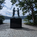
    My next stop at Lake Towada was the statue of the maidens. This turned out to be at a major tourist hub and while there were quite a few people about, it wasn’t massively crowded. It’s a bit of a walk along the lake shore to the statue, which is pretty in itself with a little island just offshore. You can rent a swan-boat to paddle about.. I chose not to! The statue is actually not of maidens, but of a maiden with her reflection to represent the view one can see on a calm day in the lake.

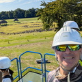
    From there I went back inland and headed to a stone circle from the Jomon era of Japan’s deep history. Most of this has long been destroyed, but in Aomori and Hookaido some remnants of this stone-age civilisation remain. The Jomon period is basically the neolithic, but the Japanese, of course, want to be special and so have categorised this period as something uniquely japanese.. The circles themselves are not as impressive as, for example, the stone circles in the UK, consisting primarily of fairly small stones arranged in various patterns. I’m sure an archeologist might be able to say more about it. Today they were holding a bit of a matsuri, but it hadn’t really kicked off yet and unfortunately I had some other things I wanted to do so didn’t stick around. I did get a free ride on a cherry-picker though to view the stone circles from above. They even got a guy specially out for me to explain in english, although it turned out he was learning german so that’s the language he decided to explain in.

    My next stop was the Osarizawa copper mine, which turned out to be closed. Google had said as much, but all the tourist signage was up so I figured I’d try anyway although give this was closed, and the later misadventure today, I would have been far better off heading back to Aomori earlier and seeing some of the other sights which I had originally wanted to go and stop off at..

    But given I was in this area, I went ahead with my plan of riding past the Subari Dam, some waterfalls, and over the Tsurubeotoshi Pass. There were few cars along this route even though the roads were pretty epic. As I got to the top of the pass, I found out why – a sign proclaiming the road to be closed, even though up to now it had none of the traditional hallmarks of a closed road such as leaf litter or disrepair. A couple of guys were camping at the top of the pass and said that yes, the road is closed to cars, but maybe a bike can get through. So it was either try, or make a major detour back the way I came and it was already getting dark..

    So I pressed on and half-way to Lake Tsugaru discovered why the road was closed – it looks like it’s being completely redone, although there didn’t seem much active work happening at the moment. The tarmac stops and heavy gravel takes its place, with some construction equipment being around. Well, it was only 6km more to the next intersection, so I turned on my spotlights and pressed on. But it was all to no avail – just in front of the intersection a locked gate barred my way. I even tried to lay the bike on its side to push it under the gate, but it was just too big.. in the end there was nothing to it but to backtrack the entire way.

    When I got back to the top of the pass the guys were taking photos of the stars – it really was an absolutely gorgeous spot up there! They even offered me some nihonshu and to let me stay the night with them so I wouldn’t have to ride back down in the dark, but as I had all my gear in the hotel I declined, as tempting as it was! So a very long dark ride back to the hotel ensued.. I really should have learned my lessons about closed roads by now!!

    Finally back at the hotel, I had a nice hot soak and a cold beer before turning in..


  • Silver Week 2026 – Day 5

    Hirosaki to Aomori

    Weather: cloudy in the morning, then sunny.  Low of 19C or so, high of 25C.
    Distance: 274km

    << Previous Day | Next Day >> | Photo Album | Video

    Today was a day of epic roads and several unexpected side quests..

    Woke up before my alarm at 6am, then slowly got ready. Surprisingly my motorbike gear was mostly dry despite having been kept in a locker overnight. I programmed the first part of the route into my phone and headed off, only then remembering that I had wanted to take a look at Hirosaki Castle. My route actually went past the castle grounds, so I did a complete loop. Unfortunately there’s no spot from which one can see the castle from the road. I stopped at one of the gates and went to take a look on foot, but the grounds are quite large and to get close to the castle you need to buy a ticket – for which it was much too early.
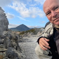
    So I jumped back on the bike and kept going, grabbing petrol and then doing my loop of Mt Iwaki. The circle-road around the mountain is actually a fair way out, and the southern and eastern sections offer some nice views onto the mountain whereas the northern and western sections are more in forests. On the recommendation of somebody I took the road up to the 8th station, being naughty and skipping the queue that had formed at the toll booth. It’s 1200yen to drive up. I had also tweaked things a bit so that my bike hit exactly 40,000km at the top!

    Here starts the first of my side-quests. My plan was just to drive up, take a look at the view, then keep going. Instead I saw a chairlift going up to 9th station, so I did that. And from there the walk to the summit was supposed to be only 40 minutes, so I did that! In all my motorbike gear… Unfortunately by the time I got to the top it was pretty cloudy and while bits and pieces of the view poked through I never could get a full picture. Still cool to have done it! I skipped back down the mountain, jumped on the bike, and headed up towards Cape Tappi, my original plan for the day!
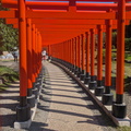
    Enroute was a my next side-quest – a sign to an Inari shrine, which I followed on the spur of the moment. Turns out it’s a pretty huge shrine, with a “walk of a thousand tori gates”. While I didn’t count them, there were a LOT and they were set into a very nicely landscaped garden. My next stop was just on the side of the road near the ocean as I was getting a bit tired – the climb up the mountain, then the stairs at the shrine, and a bit of lack of sleep and long days were taking their toll. Unfortunately I didn’t find a coffee, so I made do with a coke and a grilled squid. Squid seem to be very popular in this area!

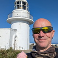
    Unexpectedly route 339 going up to Cape Tappi turned out to be open after all! This was one of the most epic roads I’ve ridden on, fast sweeping corners and stunning coastal scenery as it sweeps over the cliffs along the ocean. Cape Tappi, on the other hand, was very underwhelming, so I’m glad I had done a lot of other things earlier in the day instead of spending a lot of time at the cape as I had originally planned. The lighthouse is quite small and not open to the public and there didn’t seem to be much else on at the cape.

    So after a quick ice-cream and a look around I kept going towards Aomori. Unlike the epic road on the west coast, the east coast road is narrow and almost entirely goes through suburbia with limited overtaking opportunities and a lot of slow traffic. An exercise in patience for sure, although it has a few nice views as well. Overall a road to forget.. once into Aomori my route took me over the bay bridge and soon I was at my hotel, just a standard business hotel with the downside for bikers that they not only charge for bike parking, but also require them to park in an overflow car-park 2 blocks away..

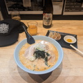
    A nice hot shower later and I went to find some Aomori cuisine – Miso Curry Milk Ramen. Sounds weird, but it was delicious! Now time to update the blog and head to bed.. it’s been another long day!


  • Silver Week 2026 – Day 4

    Shizukuishi (Iwate) to Hirosaki (Aomori)

    Weather: Mostly rainy, easing later
    Distance: 336km

    << Previous Day | Next Day >> | Photo Album | Video

    Today was a day of epic roads but rain and fog..

    Woke up to rain again. Had a coffee and my apple from yesterday while slowly getting ready. The rain eased a bit, so I left, hoping for the best.

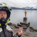
    Loop of Lake Tazawa. I was lucky, by the time I got here, the rain had pretty much finished. Very nice roads and views around the lake, the highlight being a golden statue of Tatsuko. Legend has it that in an effort to maintain her beauty forever she turned herself into a dragon and threw herself into the lake, in the process making it the deepest lake in Japan at over 420m.

    Since the weather had cleared I decided to detour over the Aspite Line instead of heading straight to Hirosaki. I had selected a silver mine as another potential waypoint, so I decided to check it out. But much to my dismay the weather moved in heavily. The road was awesome, the views presumably so, but apart from fog and rain there was little to see. The silver mine was another disappointment – a couple of crumbling apartment blocks slowly getting swallowed by vegetation and some sort of water treatment plant. So much for a museum or tour or anything really.

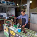
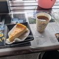
    Since it was still raining heavily I stopped at a roadside area and, as luck would have it, there was a guy making coffee. Not only that, but he also had some cheesecake! It was one of the more interesting coffee’s I ever had, made in some sort of glass retort and it bubbles and gurgles through the tubing while its brewing.

    While having coffee I chatted with someone who recommended a local onsen, famous for its ramen, and as it was still raining and I was cold and there was not much else for me to do, I decided to head there for lunch. Unfortunately when I got there the restaurant was closed.. so were half the baths, but I still enjoyed the hot bath and sauna. One of the gents in the onsen told me about a waterfall in the area; I think he said there was a good restaurant there or something, but I didn’t quite understand him. Anyway, I had had enough and just wanted to get to my hotel, but on the way I saw a huge Tori gate and a sign with the name of the waterfall, so I ended up going there after all..

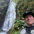
    It was a nice little detour and while not the most spectacular waterfall ever, it was still pretty nice with a little shirne along the way. No restaurant though lol.

    After the waterfall the weather had cleared enough that I decided to detour around the west side of Lake Towada. The lake is much larger than Lake Tazawa, but as the road is mostly in the forest it’s not really possible to see much of the lake. I did find one viewpoint as I was climbing out of the lake area, but it was built into tress so couldn’t see anything!

    From there it was straight to my hotel which turned out to be a capsule hotel. It’s my first time to stay in one, so it’s a bit interesting.

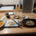
    Before turning in for the night I went to find some local food and ended up in a nearby Izakaya. I tried Igamenchi, which is chopped up fried squid and the local delicacy. I also had more local specialities in the form of dried cod with raw-egg dip, and sesame-butter crackers.

    Once I got back to my capsule hotel I went to the onsen before bed. It turns out this particular capsule hotel has one of the more famous onsen in all of Aomori, at least, according to a guy I chatted with for a bit. He’s a doctor and apparently a bit of a sauna/onsen afficionado. He’s been to Germany, Switzerland, and Sweden, looking for the best saunas. While I was there I was lucky enough to get a special sauna treat which apparently only happens a few times a month – an Aufguss cermony with tea leaves.

    That’s me done for the day.. oyasumi!


  • Silver Week 2026 – Day 3

    Yamagata to Iwate

    Weather: rainy, then heavy clouds, a late break in the evenings. Low 20’sC throughout the day.
    Distance: 450km

    << Previous Day | Next Day >> | Photo Album | Video

    Today was a day of much driving and little sight-seeing, as the typhoon had thrown a bit of a spanner in the works..

    Woke up at 5:30 to rainy weather… the plan had been to head more or less straight north of the accommodation, with one of the roads being at least partially a gravel road, so taking extra time. Along the way there were some scenic spots, a castle, and an early arrival leaving time for extra ride-outs in the area.

    In actuality, rain was not only forecast all day, but the rain radar showed heavy rain more or less along the entire route I had planned, whereas it was showing mostly dry along the east coast. So, not fancying an entire day in the rain, especially since I still don’t have proper rain gear, I decided instead to head towards Sendai and the coast roads just north from there.

    The first part of the day was interminable slow roads with queues of traffic and solid yellow lines. I was seriously second-guessing my choices of leaving behind the sparsely populated mountain roads and heading into suburbia, but the day finally got better after I peeled off to visit a dam. People sometimes wonder what my obsession with dams is.. it’s quite simple – they are usually high up in the mountains next to rivers and away from people, so perfect motorbiking territory!

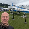
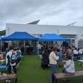
    To give my day a bit of direction I had picked out a couple of community waypoints from the BMW Mileage Rally. These turn out to be pretty hit-and-miss, some are great (like the motorbike temple the night before), others are random waypoints in the middle of nowhere.. for one I even ended up in a retirement village only because it was the center of an island! One of the better ones, and my first stop of the day, was at some sort of exhibition center for the Blue Impulse jet acrobatics team. There was also some sort of bicycle event on, so there was live music and food stalls as well as the jet exhibit.

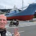
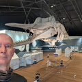
    The highlight of the day was a completely accidental stop. While riding along the coast I saw quite a large vessel on display and rode up to take a look. Turns out it is an old whaling vessel, the Tashimaru No16, which is part of the Oshika Whale Land exhibition dedicated to the history of whaling. Apart from a couple of whale skeletons and a few exhibits from whaling history there’s not a lot there.

    In general I got the impression that this part of the coast got hit pretty hard by the tsunami 15 years ago. There are a lot of brand-new villages high up in the hills, a brand-new highway, again, set up in the hills, and a lot of empty flat land near the coast with only some new fishery infrastructure and related factories.I did find some really nice roads on the Oshika Peninsula, and I definitely want to come back someday with better weather. There are some great viewpoints up in the mountains, but due to the fog I barely saw anything.

    As it was getting on and since I didn’t want to get caught out after dark again, especially if it was going to be rainy near my destination, I headed towards the highway. The way I ended up going took me a long way up the Kitakami River and, as it was up on the embankments, had a pretty nice view. Then it was 100km or so on the highway before peeling off and enjoying some nice, almost european, scenery for the last stretch near Mr Iwate.

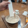
    I checked into my hotel for the night, the Pension Kumasanchi, where the owners made me feel quite welcome. First thing was onsen after such a long day in the saddle! Afterwards I went downstairs to write my diary, and the hosts gave me ところてん (tokoroten), a strange gelatinous square block which you press through a device and turns it into some sort of noodle. Eaten with soy-sauce and からし, a spice, they are quite nice with a beer.